
Over the years there has been a lot of updates to Google Maps. To satisfy the users and provide them the best experience many new features are being added. Now, Google is planning to add more colors so that users can get all the minute details of the map.
If you are using Google map street view, then you will be able to know the width of the road, whether pedestrian paths are present or not, and you can also spot the zebra crossings present down the lane. This update provides a better virtual exploring experience. Initially, Google is planning to roll out the detailed street maps in London, New York, and San Francisco. Further, over time it plans to expand to other cities.
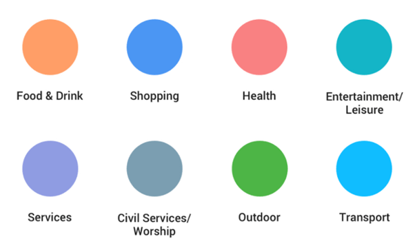
A new color-mapping algorithm is used to interpret the natural features from the satellite images. Users can spot lakes and rivers, oceans, arid beaches, deserts all in different colors. They can also view the snow caps on the mountain peaks. To provide a more realistic representation of the locations, new Google map icons have been added. For instance, imagine you are exploring a new place and you are looking for a coffee shop. Then, open Google Maps to locate the nearest orange icon. Google maps use an orange color to indicate ‘Food and Drink’ spots.
Google is working on both to enhance the natural landforms and to modify the city’s street information. With Google Maps available in 220 countries, you can witness this update is from the biggest metropolitan areas to small, rural towns.
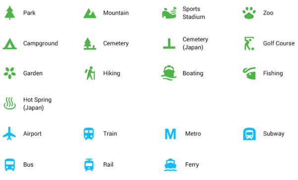
Below, is Google’s cheat sheet of the new colors and map icons (Few Google Map icons and Google Map Symbols). They have disclosed it to help you get familiar with the new update.
We can see these updates over the next few weeks in all Google products that incorporate Google Maps. It also includes the Google Assistant, Google Search, Google Earth, and Android Auto.


Leave a comment